Travel Date: 2019/08/31-09/02
Some of the worship places in Taiwan are truly unique and worth visiting. There are a few unusual temples you can find around the island, but none are as extraordinary as the one we encountered in Taitung. This place doesn't resemble a typical temple at all. What is it, you ask? It's a giant stone that looks like a penis!
Nanrenshi (男人石)
About 105 km north of Taitung, you can find a stone that resembles a massive penis. This stone stands 18 meters tall and has a diameter of 15 meters. It is commonly known as the "Men's Stone." The Men's Stone is located approximately 28 km from the Eight Immortals Cave to the north and 6 km from Sanxiantai to the south. The proximity of these landmarks has given rise to many legends. According to one legend, Lu Dongbin, He Xiangu, and Tieguan Li practiced in Sanxiantai. In this place, there lived three men and a woman. Lu Dongbin became angry and swung his sword, cutting down a pair of man and woman. Legend has it that the man turned into the stone and the woman became the cave.
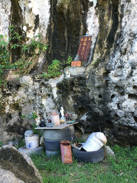
The Men's Stone is a limestone sea-eroded column with four concave walls, reaching heights of 28, 30, and 35 meters. This stone serves as evidence of seismic activity in the early earthquake-resistant site. It shares the same geological landscape as the sea-eroded rocks. In the past, these lands were inhabited by the Ami people. In their myths and legends, the Men's Stone was referred to as "kotid ni malataw," which means "the glans of the gods." In another story, this stone was named "fasonihar," meaning "the place where the kites are tied." Later, a temple was built here with nine more stone-carved phalluses. Today, the Men's Stone has become a pilgrimage site and follows a set of standard rituals and prayers. In addition to seeking blessings for marriage and children, visitors can also pray for wealth, career success, and good health. It is a unique religious and cultural attraction.
See also: Sanxiantai
Shiyusan Scenic Area (石雨傘風景區)
Shiyusan is a well-known geological landscape on the east coast. It is located 10 km north of the town and stretches for 1 km along the coast. It belongs to the sea-eroded top of the limestone uplift and showcases various features such as sinuous reefs, narrow rocks, balanced rocks, pot holes, and sea-eroded doors. Among them, the most famous feature is the balanced rock. A relatively slender rock supports a large coral reef, creating a special balance structure that resembles an umbrella, hence the name "stone umbrella." The natural barrier formed by the stone umbrellas blocks the waves from the open sea, making it a safe place to enjoy activities such as walking barefoot on the dark sand, admiring the blue waters, and experiencing the unique geological features up close. The stone umbrellas exude a fascinating and cozy maritime atmosphere.
The elephant-like shaped abrupt rock belongs to the conglomerate of the large port layer. Due to long-term erosion by seawater, its softer parts have been divided into several sections, resulting in a hollow sea-eroded landscape that locals refer to as a "stone nose." The beach is covered with dark iron sands, and you can observe a group of hermit crabs scurrying about.
The sea-eroded topography of the stone umbrellas includes balanced rocks, pot holes, dissolved topography, granular layers, deformed shale blocks, and calcareous nodules. Besides the famous balanced rock, the pot holes on the stone nose board are also well-developed. Some of these pot holes measure 3.5 meters in diameter and 1.5 meters in depth, resembling large tubs. There are smaller holes within these larger ones, with diameters of about 5 cm, which are believed to be excavated by marine life.
Among the diverse geological landscapes, the most famous feature is the balanced rock. The balanced rock refers to a massive rock mass that is connected to the ground by a small part, maintaining its balance. This unique landscape is the result of different rock textures on the upper and lower sides. The upper part consists of hard coral reef rock, while the lower part is composed of slightly weaker conglomerate rock. Over time, differential erosion has caused the lower conglomerate to be exploited, resulting in the formation of various sizes of balanced rocks. The balanced rock at the stone nose is a coral reef block that fell from the sea cliff and settled on the weaker conglomerate. Differential erosion has created a distinctive balance structure that resembles a natural umbrella, thus earning it the name "stone umbrella."
See also: National Museum of Prehistory
Chengguangao Cultural Landscape Guanghengfa Company (成廣澳文化地景 廣恆發商號)
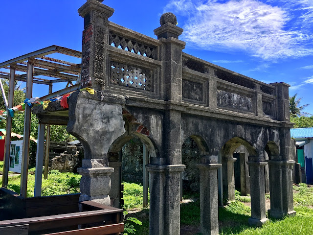
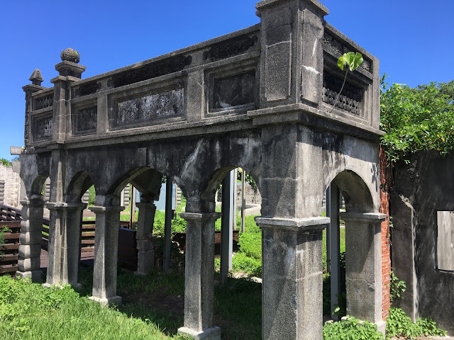
The Chengguangao Cultural Landscape Park was originally the site of Guanghengfa Shang and was once the foremost trading company on the eastern coast of Taiwan. The park features a three-arched archway with Baroque-style elements and a brick arched building known as "Ting Tsai," all constructed with stone, showcasing the wealth of the Wen family.
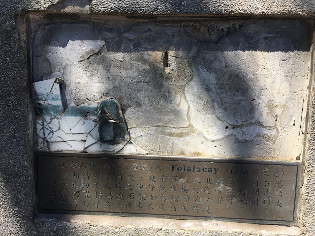
Chengguangao, also known as Xiaogang, is a natural deep-water harbor. According to legend, during the late Ming Dynasty, Han Chinese merchants came here for business purposes. Chengguangao served as a significant stronghold for the Han people on the east coast during the Qing Dynasty. In 1894, Wen Taikun, a Hakka from Pingtung in Pinghu, arrived in Chengguangao. He founded Guanghengfa, the first company on the east coast, which eventually became the largest grocery store in Huadong.
When the eastern coastal road was widened, the archway on the north side was destroyed. However, the commercial facade and the pavilion foot of the remaining Baroque buildings are still identifiable. Only about one-third of the broken wall remains, concealed by smog and vines. The "Chengguangao Cultural Landscape" setting now stands as a witness to the development history of the Han people on the east coast.
Baxiandong Archaeological Site (八仙洞)
Unfortunately, this site was closed for renovation during our visit, so we could only admire it from the outside and enjoy a meal nearby.
Baxiandong is one of the must-visit destinations on the east coast of Taiwan. It is the site where the Changbin culture of the Old Stone Age was discovered, making it a first-class monument in Taiwan. Baxiandong features dozens of sea caves, and visitors can walk along the wooden walkways next to the caves, observing the lush forests and rich ecology along the way. When tourists reach Yongan Cave, they can descend and explore the sea-level landforms of the Changbin region. The Baxiandong Trail connects various sea caves, each displaying its own unique shape. These sea caves were formed through erosion of the softer parts of the rock walls by waves during the uplift process of the east coast's crust. Each cave varies in shape and size, with heights exceeding 10 meters, creating a truly spectacular sight.
The sea caves within the Eight Immortals Cave were transformed into altars, giving the cave complex a strong religious atmosphere. The largest sea cave is known as Lingyan Cave, while the highest ground is called Kunlun Cave. Although the temples within the caves have been demolished, the Baxiandong Visitor Center features a special exhibition hall displaying numerous stone tools, cultural relics, and restoration models for visitors to explore. It is a captivating attraction that showcases both geological beauty and cultural heritage.
Interpretation of the prehistoric cultural sites is available at the Eight Immortals Visitor Center.
The caves of Baxiandong are composed of volcanic agglomerates from the Dudu Mountain Formation, characterized by their hardness and stoniness. These agglomerates were formed during submarine volcanic eruptions millions of years ago. As the coast experienced intermittent uplift, erosion by seawater created the sea caves. Since the coast continues to rise, the caves are ordered from top to bottom, with the lower caves being younger. The caves exhibit two main shapes: upright and lateral semicircular.
The gravel beach at Baxiandong is adorned with pebbles of various colors. It serves as a gathering point for the igneous rocks from the coastal mountains and the metamorphic rocks from the Central Mountains. Alongside andesite and metamorphic meteorites, you can also find a wide variety of stones. The volcanic breccia bedrock, having endured the relentless pounding of powerful waves and the northeast monsoon, has created a series of magnificent sea-eroded ditches.


0 komentarze:
Post a Comment