October 28, 2019

Hualien Travel: Yuedong and Shitiping Recreation Area

shitiping recreational area, taitung, taiwan

Travel Date: 2019/08/31-09/02

Unfortunately, we had less than half a day in Hualien during our trip. We only made quick stops at places on the way to our hotel and visited the Night Market. However, that night our son developed croup and had difficulty breathing. We rushed him to the hospital and stayed overnight. The previous day, he had been coughing, particularly before sleep, and had refused to eat dinner. I wanted to take him to see a doctor earlier, but my husband thought I was overreacting, as many mothers might feel. The next day, he was feeling better, but there was a typhoon approaching, and we weren't sure if we would be able to leave if we stayed longer in the hospital. It was a difficult decision, but we discharged him from the hospital around noon and brought him back to Tainan. He had stayed in the hospital in Hualien for about 16 hours, and he was already breathing well and seemed energetic. The journey back home took around 7 hours, but fortunately, he didn't cry, which made it easier for him to breathe. We visited the hospital once we arrived home to ensure he was fine and received additional medicine. He gradually got better, but the illness brought about changes in him. Suddenly, he stopped drinking milk (he was 18 months old at the time), and he no longer slept during the afternoon. It has already been 2 months since our trip to the east of Taiwan, and now I can barely find time to write my blog and bake cakes for sale. However, I'm happy that he is healthy again.

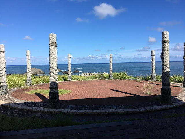
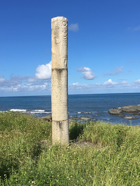
Sea Worship Area (海祭場)

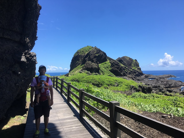
We made a quick stop at this place, which is used by the aboriginal people for praying to the sea god. There was nobody around when we visited.

aboriginal sea worship area, taitung, taiwan

aboriginal sea worship area, taitung, taiwan 

aboriginal sea worship area, taitung, taiwan

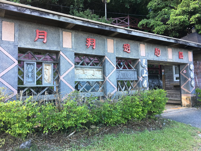
Yuedong Recreation Area (月洞遊憩區)

Yuedong is situated in Fengbin Township of Hualien County, about 1 km from the port village of Shitiping. It is a natural stalactite cave with a pool of water about 5 meters deep inside. The water level in the cave rises and falls with the phases of the moon, hence its name "Moon Cave." Moon Cave is located approximately 80 meters above sea level, around 800 meters from the coast, with an entrance height of about 25 meters and a length of about 176 meters. It has a unique shape with two caves inside. The left cave is larger and deeper, extending about 50 meters. At the end, thousands of bats can be seen hanging from the narrow ceiling. The right cave is shorter, spanning approximately 40 meters. The cave exudes a mysterious darkness, with bats clinging to stalactites throughout. It also showcases volcanic rocks, stalagmites, bird's nest fossils, fish head fossils, and other intriguing landscapes. To explore the cave, visitors must take a boat operated by a guide. The boat is equipped with lighting, and the temperature inside Moon Cave is around 20 degrees Celsius, providing a warm environment in winter and a cool respite in summer. It is suitable for swimming all year round.

yuedong recreational area, taitung, taiwan

yuedong recreational area, taitung, taiwan

yuedong recreational area, taitung, taiwan

yuedong recreational area, taitung, taiwan

Shitiping (石梯坪)

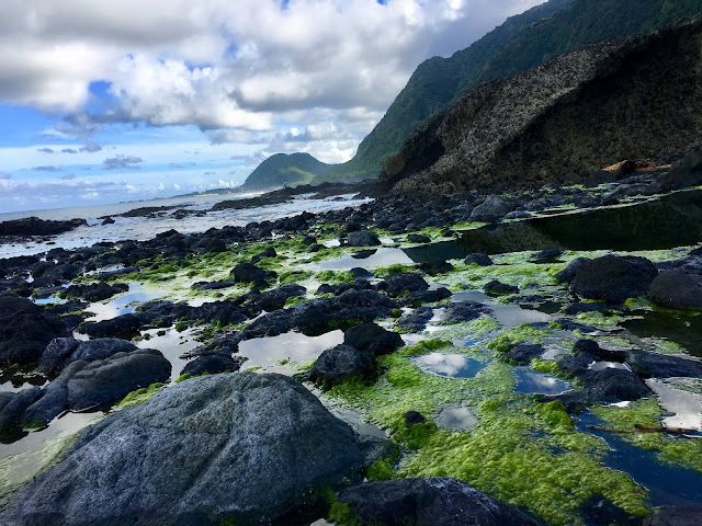
Shitiping boasts a distinctive rocky landscape carved by wind and seawater. The tides in the area are rich in natural ecological resources, housing crabs, starfish, hermit crabs, and colorful fish. It is a perfect spot to set up camp on the sea erosion platform and witness the morning sun breaking through the clouds, casting a golden glow on the sea. 
The entire area consists of an expansive coastal terrace with well-developed sea erosion terrain. Visitors can admire sea erosion platforms, uplifted coral reefs, sea erosion ditches, sea erosion cliffs, and potholes. Shitiping is also a bustling port where fishing boats bring in fresh catches. It is considered the birthplace of whale watching in Taiwan. During the summer, whales and dolphins can often be spotted, attracting tourists to embark on whale-watching boats and marvel at their elegant presence. 

The Shitiping tribe, known as Tidaan, was formed by the migration of various ethnic groups to the port tribe. The main ethnic group is the Ami, followed by the Han Chinese. The tribe's ceremonies, music, and lifestyles bear similarities to the port tribes located 2 km away. The fishing festival in mid-June and the Harvest Festival in late July are the main cultural events in the region. In order to preserve the ancestral crafts, the Shitiping tribe established a craft workshop. 
Additionally, they actively participate in the preservation of traditional culture through witch dances, traditional coarse foods, and wine-making traditions. Along the southeast corner of the coast, you can observe hills with a pale white color. The landward side of these hills gradually slopes, while the seaward side is steeply inserted into the sea, forming a "single-sided mountain" with different inclination angles on each side. 
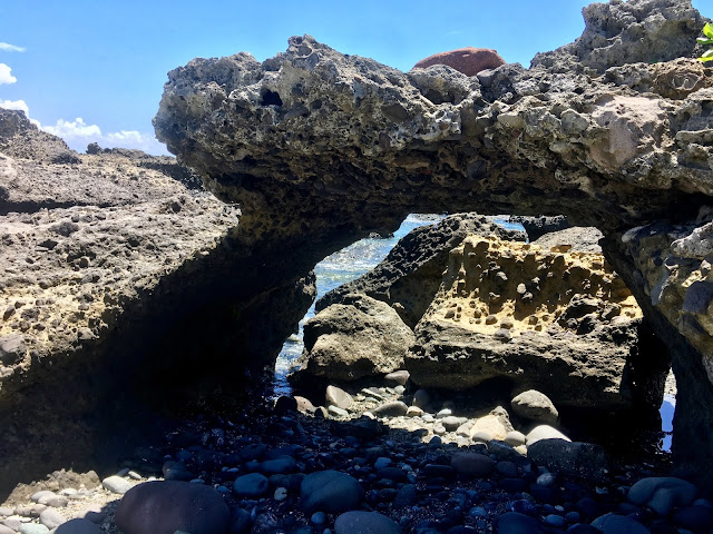
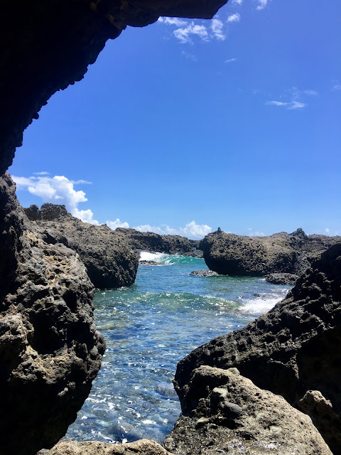
Small single-sided mountains can be seen throughout the Shitiping area. The slope on the seaward side of the single-sided mountain forms a natural stone ladder eroded by the waves. Natural sea arches are often found in prominent areas with strong sea erosion. After millions of years of sea waves, the final hole is formed, creating a sea erosion gate, also known as a "sea arch." The coast is dotted with numerous narrow "sea erosion ditches."

shitiping recreational area, taitung, taiwan

shitiping recreational area, taitung, taiwan

shitiping recreational area, taitung, taiwan

Shitigang (石梯漁港拍賣市場)

Shitigang Port is located on the northwest side of Shitiping. It holds the distinction of being the birthplace of whale watching in Taiwan, with the highest chance of spotting whales and dolphins in the country. Over 16 species of cetaceans can be found in the open sea, and the most common ones include the tropical spotted dolphin with white spots on its fins, the group-loving Fraser's dolphin, and the spinner dolphin known for its acrobatic spins. The chance of encountering whales and dolphins during a sea excursion is as high as 9.5 percent.

Shimen (石門休憩區)

About 5 kilometers north of Shitiping, you'll find Shimen Beach, a stretch of reef coast that spans several kilometers. It derives its name from a sea-shaped cave found on the beach, which features three interconnected holes. The cave measures approximately 18 meters in width and nearly 5 meters in height. From Shimen Cave to the coast between the People's Victory Day monuments, you can witness well-developed sea erosion landscapes, including sea caves, potholes, sea erosion platforms, and sea erosion ditches. The reef coast serves as a fertile ground for various types of seaweed, while fish and shrimps thrive in the area. As a result, Shimen is not only a popular fishing spot but also a natural classroom for observing coastal marine life.

shitiping recreational area, taitung, taiwan

shitiping recreational area, taitung, taiwan

shitiping recreational area, taitung, taiwan

Address: 

1. 海祭場: 977花蓮縣豐濱鄉海祭場
2. Yuedong Recreation Area: 977花蓮縣豐濱鄉月洞遊憩區
3. Shitiping: 977花蓮縣豐濱鄉台11線石梯坪
4. Shimen: 977花蓮縣豐濱鄉石門班哨角休憩區

October 22, 2019

Taitung Travel: The Nanrenshi and Shiyusan Scenic Area

Travel Date: 2019/08/31-09/02

Some of the worship places in Taiwan are truly unique and worth visiting. There are a few unusual temples you can find around the island, but none are as extraordinary as the one we encountered in Taitung. This place doesn't resemble a typical temple at all. What is it, you ask? It's a giant stone that looks like a penis!

Nanrenshi (男人石)

About 105 km north of Taitung, you can find a stone that resembles a massive penis. This stone stands 18 meters tall and has a diameter of 15 meters. It is commonly known as the "Men's Stone." The Men's Stone is located approximately 28 km from the Eight Immortals Cave to the north and 6 km from Sanxiantai to the south. The proximity of these landmarks has given rise to many legends. According to one legend, Lu Dongbin, He Xiangu, and Tieguan Li practiced in Sanxiantai. In this place, there lived three men and a woman. Lu Dongbin became angry and swung his sword, cutting down a pair of man and woman. Legend has it that the man turned into the stone and the woman became the cave.

The Men's Stone is a limestone sea-eroded column with four concave walls, reaching heights of 28, 30, and 35 meters. This stone serves as evidence of seismic activity in the early earthquake-resistant site. It shares the same geological landscape as the sea-eroded rocks. In the past, these lands were inhabited by the Ami people. In their myths and legends, the Men's Stone was referred to as "kotid ni malataw," which means "the glans of the gods." In another story, this stone was named "fasonihar," meaning "the place where the kites are tied." Later, a temple was built here with nine more stone-carved phalluses. Today, the Men's Stone has become a pilgrimage site and follows a set of standard rituals and prayers. In addition to seeking blessings for marriage and children, visitors can also pray for wealth, career success, and good health. It is a unique religious and cultural attraction.

See also: Sanxiantai

nanrenshi man's stone, taitung, taiwan

nanrenshi man's stone, taitung, taiwan

nanrenshi man's stone, taitung, taiwan

nanrenshi man's stone, taitung, taiwan

nanrenshi man's stone, taitung, taiwan

nanrenshi man's stone, taitung, taiwan

Shiyusan Scenic Area (石雨傘風景區)

Shiyusan is a well-known geological landscape on the east coast. It is located 10 km north of the town and stretches for 1 km along the coast. It belongs to the sea-eroded top of the limestone uplift and showcases various features such as sinuous reefs, narrow rocks, balanced rocks, pot holes, and sea-eroded doors. Among them, the most famous feature is the balanced rock. A relatively slender rock supports a large coral reef, creating a special balance structure that resembles an umbrella, hence the name "stone umbrella." The natural barrier formed by the stone umbrellas blocks the waves from the open sea, making it a safe place to enjoy activities such as walking barefoot on the dark sand, admiring the blue waters, and experiencing the unique geological features up close. The stone umbrellas exude a fascinating and cozy maritime atmosphere.

The elephant-like shaped abrupt rock belongs to the conglomerate of the large port layer. Due to long-term erosion by seawater, its softer parts have been divided into several sections, resulting in a hollow sea-eroded landscape that locals refer to as a "stone nose." The beach is covered with dark iron sands, and you can observe a group of hermit crabs scurrying about.
The sea-eroded topography of the stone umbrellas includes balanced rocks, pot holes, dissolved topography, granular layers, deformed shale blocks, and calcareous nodules. Besides the famous balanced rock, the pot holes on the stone nose board are also well-developed. Some of these pot holes measure 3.5 meters in diameter and 1.5 meters in depth, resembling large tubs. There are smaller holes within these larger ones, with diameters of about 5 cm, which are believed to be excavated by marine life.

Among the diverse geological landscapes, the most famous feature is the balanced rock. The balanced rock refers to a massive rock mass that is connected to the ground by a small part, maintaining its balance. This unique landscape is the result of different rock textures on the upper and lower sides. The upper part consists of hard coral reef rock, while the lower part is composed of slightly weaker conglomerate rock. Over time, differential erosion has caused the lower conglomerate to be exploited, resulting in the formation of various sizes of balanced rocks. The balanced rock at the stone nose is a coral reef block that fell from the sea cliff and settled on the weaker conglomerate. Differential erosion has created a distinctive balance structure that resembles a natural umbrella, thus earning it the name "stone umbrella."

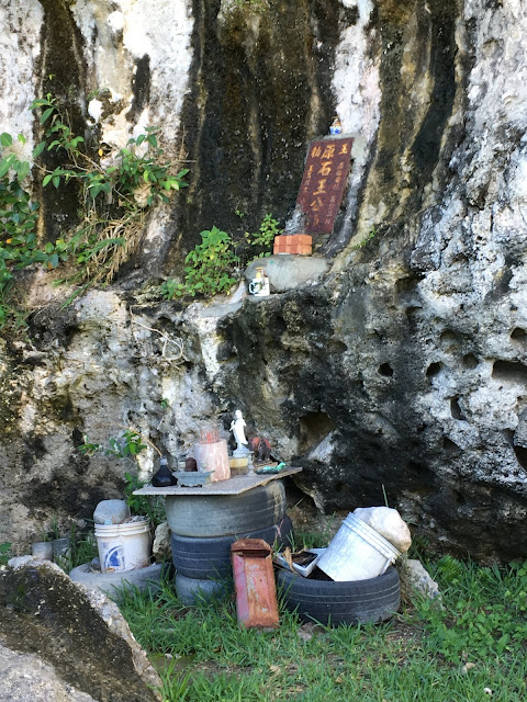
Chengguangao Cultural Landscape Guanghengfa Company (成廣澳文化地景 廣恆發商號)

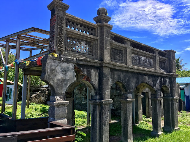
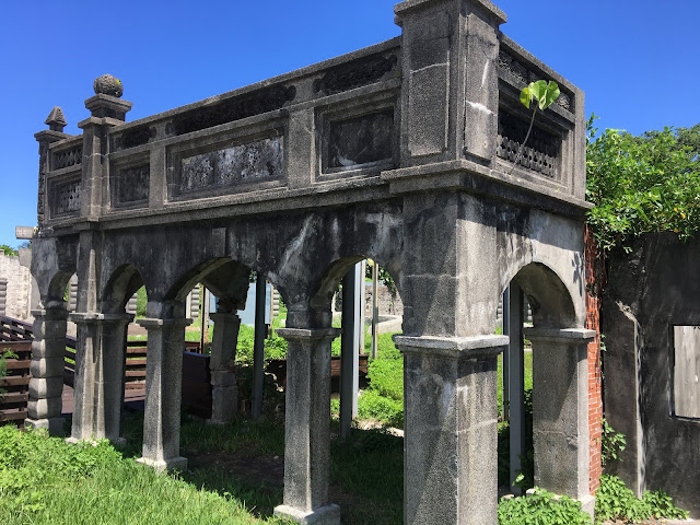
The Chengguangao Cultural Landscape Park was originally the site of Guanghengfa Shang and was once the foremost trading company on the eastern coast of Taiwan. The park features a three-arched archway with Baroque-style elements and a brick arched building known as "Ting Tsai," all constructed with stone, showcasing the wealth of the Wen family.

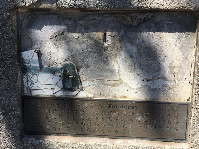
Chengguangao, also known as Xiaogang, is a natural deep-water harbor. According to legend, during the late Ming Dynasty, Han Chinese merchants came here for business purposes. Chengguangao served as a significant stronghold for the Han people on the east coast during the Qing Dynasty. In 1894, Wen Taikun, a Hakka from Pingtung in Pinghu, arrived in Chengguangao. He founded Guanghengfa, the first company on the east coast, which eventually became the largest grocery store in Huadong.

When the eastern coastal road was widened, the archway on the north side was destroyed. However, the commercial facade and the pavilion foot of the remaining Baroque buildings are still identifiable. Only about one-third of the broken wall remains, concealed by smog and vines. The "Chengguangao Cultural Landscape" setting now stands as a witness to the development history of the Han people on the east coast.

Chengguangao Cultural Landscape Guanghengfa Company, taitung, taiwan

Chengguangao Cultural Landscape Guanghengfa Company, taitung, taiwan

Chengguangao Cultural Landscape Guanghengfa Company, taitung, taiwan

Chengguangao Cultural Landscape Guanghengfa Company, taitung, taiwan

Chengguangao Cultural Landscape Guanghengfa Company, taitung, taiwan

Baxiandong Archaeological Site (八仙洞)

Unfortunately, this site was closed for renovation during our visit, so we could only admire it from the outside and enjoy a meal nearby.

Baxiandong is one of the must-visit destinations on the east coast of Taiwan. It is the site where the Changbin culture of the Old Stone Age was discovered, making it a first-class monument in Taiwan. Baxiandong features dozens of sea caves, and visitors can walk along the wooden walkways next to the caves, observing the lush forests and rich ecology along the way. When tourists reach Yongan Cave, they can descend and explore the sea-level landforms of the Changbin region. The Baxiandong Trail connects various sea caves, each displaying its own unique shape. These sea caves were formed through erosion of the softer parts of the rock walls by waves during the uplift process of the east coast's crust. Each cave varies in shape and size, with heights exceeding 10 meters, creating a truly spectacular sight.

The sea caves within the Eight Immortals Cave were transformed into altars, giving the cave complex a strong religious atmosphere. The largest sea cave is known as Lingyan Cave, while the highest ground is called Kunlun Cave. Although the temples within the caves have been demolished, the Baxiandong Visitor Center features a special exhibition hall displaying numerous stone tools, cultural relics, and restoration models for visitors to explore. It is a captivating attraction that showcases both geological beauty and cultural heritage.
Interpretation of the prehistoric cultural sites is available at the Eight Immortals Visitor Center.

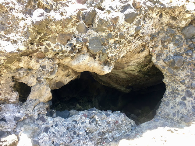
The caves of Baxiandong are composed of volcanic agglomerates from the Dudu Mountain Formation, characterized by their hardness and stoniness. These agglomerates were formed during submarine volcanic eruptions millions of years ago. As the coast experienced intermittent uplift, erosion by seawater created the sea caves. Since the coast continues to rise, the caves are ordered from top to bottom, with the lower caves being younger. The caves exhibit two main shapes: upright and lateral semicircular.
The gravel beach at Baxiandong is adorned with pebbles of various colors. It serves as a gathering point for the igneous rocks from the coastal mountains and the metamorphic rocks from the Central Mountains. Alongside andesite and metamorphic meteorites, you can also find a wide variety of stones. The volcanic breccia bedrock, having endured the relentless pounding of powerful waves and the northeast monsoon, has created a series of magnificent sea-eroded ditches.

baxiandong archeological cave, taitung, taiwan

baxiandong archeological cave dailily soup, taitung, taiwan

baxiandong archeological cave, taitung, taiwan

baxiandong archeological cave, taitung, taiwan

baxiandong archeological cave, taitung, taiwan

Address:

1. Nanrenshi: 961台東縣成功鎮石傘路男人石
2. Shiyusan Scenic Area: 961台東縣成功鎮石雨傘風景區
3. Chengguangao Cultural Landscape Guanghengfa Company: 961台東縣成功鎮成廣路成廣澳文化地 景廣恆發商號
4. Baxiandong Archeological Site: 962台東縣長濱鄉三間村水母丁1-4號八仙洞

October 16, 2019

Taitung Travel: Visiting Sanxiantai

snaxiantai, taitung, taiwan

Travel Date: 2019/08/31-09/02

Sanxiantai (三仙台) 

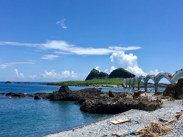
Sanxiantai (三仙台) is a well-known tourist attraction in Taitung County. It is located about three kilometers northeast of Chenggong Town. It consists of an offshore small island, a coral reef coast, and a gravel coast. The area covers about 22 hectares, and it takes approximately one hour to explore. Due to minimal human disturbance, it is also an important site for studying coastal plant ecology and has been designated as a nature reserve. In the Ami language, "nuwalian" means "the most eastern place," and "Pisirian" means "the land of the shepherd."
Sanxiantai is now managed as part of the Eastern Coast National Scenic Area and has the "Sanxiantai Tourist Service Center," which provides information on the ecological environment and tourism-related consultations.

At the highest point, about 77 meters above sea level, it belongs to the volcanic agglomerate of Tuoshan Mountain. Over the years, erosion by seawater has transformed it into an offshore island. Surrounding the island are raised coral reefs. The north side of the island features a gravel beach, and when tides and waves crash onto the shore, they create a loud sound. Through long-term weathering and seawater erosion, unique sea-eroded formations such as sea-eroded columns, potholes, and tunnel-like sea-eroded gates have been formed. Moving west from Sanxiantai, you'll encounter multi-layered sea-level topography and stepped sea terraces.

Volcanic agglomerate forms the main structure of the Sanxiantai strata, with numerous sea-eroded columns present throughout the area. Smaller sea-eroded columns can be found near the parking lot, while the three large sea-eroded columns are situated on Sanxiantai Island, reaching a height of about 80 meters. The northern end of the island features several potholes, with the largest having a diameter of 5 meters and a depth of 4 meters. On the northeast coast, there is a tunnel-like sea-eroded gate known as Acacia Cave, measuring 58 meters in length, 3 meters in width, and 3 meters in height. Along the rocky block, which stretches through the northeast of the island, there is a shortcut to the southern bank. Visitors can observe Taiwan's coastal plants, such as jujube, white water wood, and lentils, in this area.

Both the Han people and the local Ami people have their own legends surrounding Sanxiantai. According to legend, Li Tiezhu, Lu Dongbin, and He Xiangu from the "Eight Immortals" once stopped on the island, leaving their presence in the mountains, thus giving rise to the name Sanxiantai. The Ami people have a story circulating about the possession of the patron saint "Wu'an" in Sanxiantai.

The Sanxiantai Lighthouse is located on the second peak of Sanxiantai Island, and there are 287 stone steps leading from the base of the rock to the lighthouse. In 1987, an eight-arch cross-sea pedestrian bridge was constructed to facilitate tourists' access to the island. Due to its beautiful design, it has become a local landmark. Fixed fishing nets can be found in the waters between Sanxiantai and Baishoulian on Taiwan's main island. Fishermen have obtained permission from the Xingang District Fisheries Association to place these nets there.

snaxiantai, taitung, taiwan

snaxiantai, taitung, taiwan

snaxiantai, taitung, taiwan

snaxiantai, taitung, taiwan

snaxiantai, taitung, taiwan

snaxiantai, taitung, taiwan

snaxiantai, taitung, taiwan

Address:

961台東縣成功鎮基翬路74號三仙台跨海步橋

October 9, 2019

Taitung Travel: Donghe - the Monkey Valley in Taidong

Travel Date: 2019/08/31-09/02

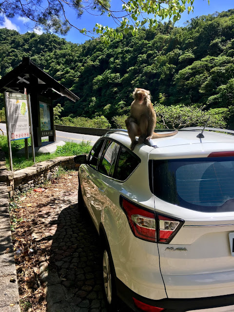
t's our last day in Taitung (we only stayed here for 2 days), and tomorrow we're heading to Hualien. Thanks to my husband's uncle, we've visited some places that most local people would go to and discovered many shortcuts that Google Maps would never show you. Unfortunately, one day it rained heavily, so we could only visit the museum. The road to Hualien is filled with many attractions along the coastal area. We hope to see as many as possible, but we also had to cancel some of our plans due to lack of time. Seeing wild monkeys was a first-time experience for me. We went there twice because the weather was too bad on the first day. A monkey followed me, and I got scared and quickly jumped into the car. Unfortunately, the animal sat on our car's roof, doors, mirrors, and so on. The east coast is very beautiful, but unfortunately, we didn't have a chance to go to the beach. Usually, we made quick stops at many nearby places to see as much as possible.

Donghe Village (泰源幽谷)

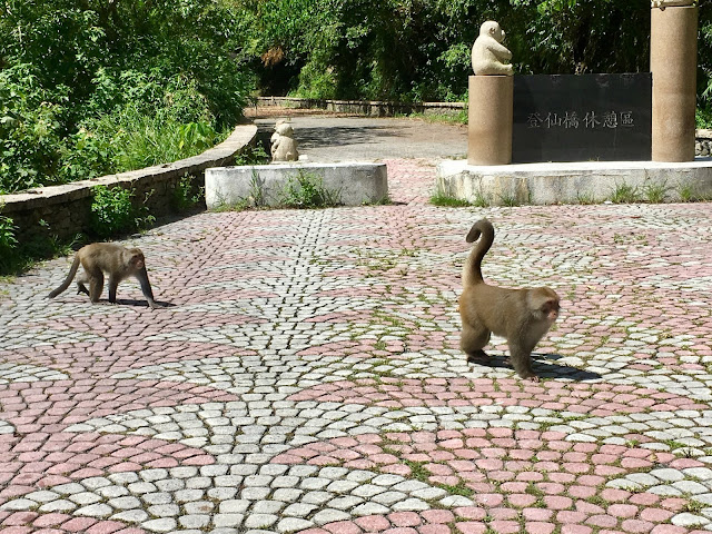
From Donghe Bridge, along the Dongfu Highway into the coastal mountains, you can reach the famous Taiyuan Valley. It is surrounded by mountains and eroded by rivers, forming a canyon terrain. Taiyuan Valley is also a paradise for Taiwanese macaques. Monkeys can often be seen in the woods or directly approaching tourists for food, creating a unique scenery. It is the best place to enjoy monkeys in Taitung, adding more to the journey. Monkeys are easily seen near the bridge in the area. Be careful and don't take anything out of your car, as they will chase you. It's just a quick stop, not far from the main coastal road. Donghe Township has an old name, Fafukod (馬武窟), which means "fishing by net" in the Ami language. Many prehistoric artifacts have been found at the Dulan Site. In 1920, during Japanese rule, the Toran local office was established. In 1937, it was changed to Toran Village (都蘭庄) under Shinkō District (新港郡), Taitō Prefecture. The name "Donghe Township" was established after World War II and is currently used.

Newer post from Donghe: HERE

wild monkeys, donghe taitung, taiwan

wild monkeys, donghe taitung, taiwan

wild monkeys, donghe taitung, taiwan

wild monkeys, donghe taitung, taiwan

wild monkeys, donghe taitung, taiwan

wild monkeys, donghe taitung, taiwan

金樽陸連島

The Jinyu Recreation Area consists of a small bay, an offshore reef, a long sandy beach, and a coastal cliff. The bay is shaped like a wine glass and is called "Golden Dragonfly." Jinmao has a 3km stretch of soft beaches.

sea view, beach and mountains, taitung, taiwan

sea view, beach and mountains, taitung, taiwan

sea view, beach and mountains, taitung, taiwan

Amis Folk Center (阿美族民俗中心)

The Ami Folk Center is located next to the headquarters of the East Tube Office and covers an area of about 2 hectares. It features outdoor performance plazas, outdoor stands for 2,000 people, archery experience areas, Ami traditional houses, and more. Visitors can engage in DIY activities like making Ami beading or traditional instrumental flutes, or enjoy Ami traditional song and dance performances. It offers a chance to experience Ami culture and have fun with parents and children.

The Ami Folklore Center was completed in November 1995. The main building's sacred houses and homes were hand-painted according to the Japanese ethnologist Qian Qianyan. They imitated the priests of the Taiba Bengshe in Hualien County to build a home. Visiting here allows you to witness the unique living culture of the Ami.
Ami traditional houses are mostly made of thatch. In addition to visiting the famous buildings and understanding the beauty of Ami architecture, the folk center also features tribal cultural relics exhibitions, handicrafts, special product exhibitions, and food services.

The Ami ethnic group is located east of the Liwu River and the east coast of the East Coast. It has a population of about 140,000 and is the most populous group among Taiwan's aboriginal people. The Ami still retains a rich traditional culture. The Harvest Festival is the most representative traditional ritual. It is held every summer to celebrate the harvest of millet, offer sacrifices to ancestors and gods, and express gratitude. The ceremony is full of blessings and emphasizes the ethics of pursuing the future and unity.

Since the Ami society is predominantly matriarchal, the ideal Ami family house is long and wide, with a capacity of about 20 people. Ami traditional houses are mostly made of thatched roofs, wooden pillars, vertical bamboo side walls, and indoor rattan-woven elevated beds. Generally, houses usually need to be rebuilt after more than ten years of residence. The thatch on the roof needs to be replenished every year, and replacement is required every three to four years.

amis folk center, taitung, taiwan

八嗡嗡海岸

In the Ami language, it is called "Paong'ong." There are two explanations for the origin of the place name. One is related to the nearby Kanatoron Creek and Chiinawan Creek. The Ami people call it "paongowan." The other explanation is that the area has many Papaongay plants. The buds of this plant have refreshing properties and can repel mosquitoes when burned. It is said that children who eat Papaongay's buds perform better in spiritual learning. Over time, the place became known as Paong'ong or Papaongay.


sea view, taitung, taiwan

sea view, taitung, taiwan

sea view, taitung, taiwan

Museum of Natural History (台東縣自然史教育館)

The Taitung County Natural History Education Center displays a collection of 557 shell specimens and features mineral display rooms showcasing marine treasures and ores from around the world. It combines natural resources with educational functions.
The mineral exhibition room on the third floor displays over 200 ore rocks from Hualien and Taitung, including gemstones from the coastal mountains like sapphire. You can observe the contrast between original stones and carved stones.
Taiwan's Lanbao original stone was first unearthed during the Japanese colonial rule. It was discovered by the aborigines in Dulan Mountain. It is a 70-centimeter-long, 30-centimeter-wide, and 30-centimeter-high blue translucent stone that officially unveiled the upsurge of the East Coast Mountains.

Address: 

1. Monkeys: 959台東縣東河鄉東富公路登仙橋遊憩區
2. 金樽陸連島: 959台東縣東河鄉七里橋11號金樽陸連島
3. Amis Folk Center: 961台東縣成功鎮新村路25號阿美族民俗中心
4. Museum of Natural History: 961台東縣成功鎮基翬路16號台東縣自然史教育館