Showing posts with label island. Show all posts

November 27, 2019

Pingtung Travel: Sea Turtles and Other Attractions of XiaoLiouQiu

sea turtle, xiaoliuqiu, pingtung, taiwan

For the first time, I visited one of Taiwan's islands, Xiaoliuqiu. It was truly an amazing place with beautiful beaches, a blue ocean, and shells and dead corals scattered on the shore. I even had the chance to see two live corals near the shore. But the most exciting part was encountering sea turtles. They were incredibly beautiful, and it was easy to spot them swimming close to the beach.
The weather in mid-November was already starting to cool down. We had to wear jackets in the morning and at night when going outside. Only during noon was it hot enough for us to go swimming. Unfortunately, we ended up getting sunburned, and our son was scared to get into the water.

On Sunday afternoon, there were many people on the island. However, when we went on Monday, the place was nearly empty, and we could enjoy the island almost by ourselves. The trip cost us about 5000 (excluding transportation to Donggang Harbour). We booked a hotel on the west coast, which was really nice. The price included boat tickets and a scooter rental for 24 hours.
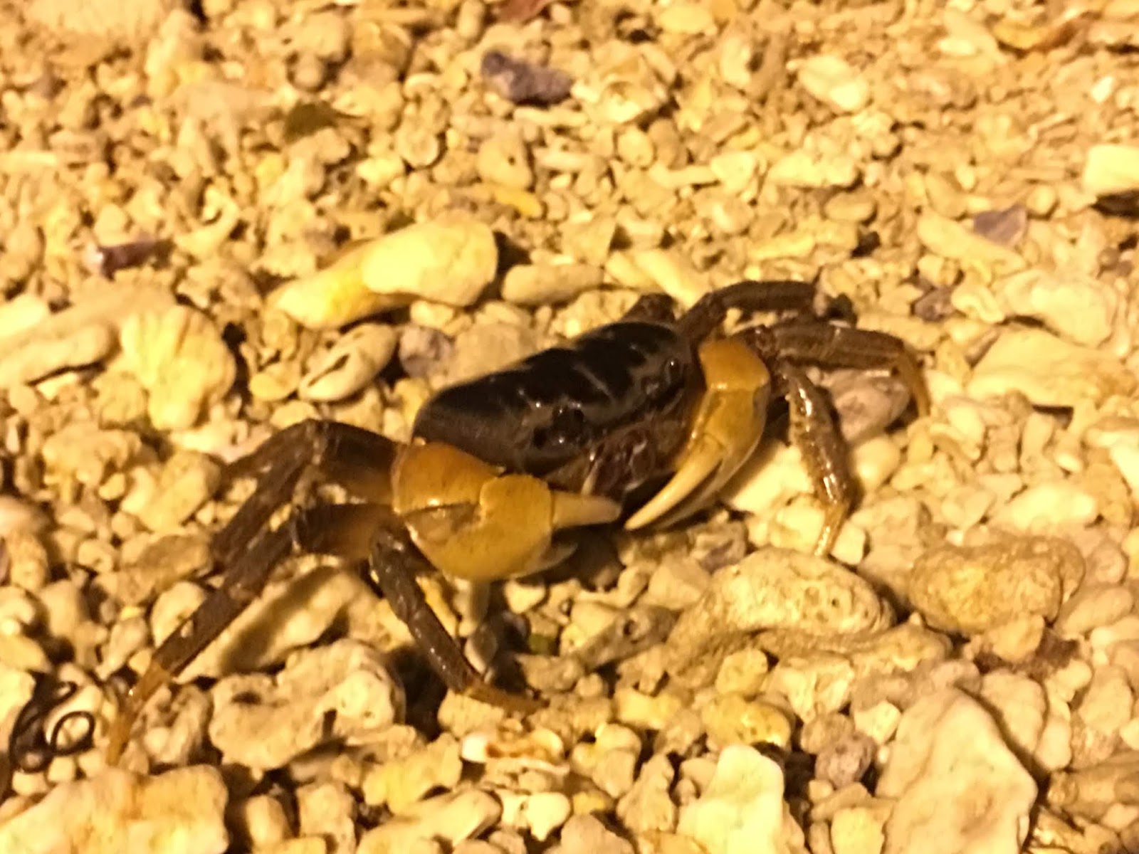
The island is very small, and we drove around it several times. We even went out at night, although it may not be a good idea in some areas as many places are completely dark. On some roads, we noticed signs saying "crab crossing, please slow down." I didn't see any crabs on the road, but according to my husband's past experience, it happens quite often at night. We also went to the beach at night and saw two large crabs and some other sea animals. The next day, we saw a few sea turtles on the beach, swimming very close to us. We also had the opportunity to see different fish and corals.

The biggest attractions on the island are the beaches, Vase Rock, and a few caves. It's a popular place for snorkeling and observing sea turtles. Unfortunately, we didn't visit any caves during our trip. Besides the beaches, we also visited the Lighthouse and Banyan Tree. I had wanted to see the sunrise, but it was difficult to convince my husband to wake up early. Next time, we should find a hotel on the east side of the island instead.
There is a small town in the north, close to the harbor and Vase Rock, where we saw many tourists, especially foreigners.


vase rock, xiaoliuqiu, pingtung, taiwan

vase rock, xiaoliuqiu, pingtung, taiwan

xiaoliuqiu, pingtung, taiwan

lighthouse, xiaoliuqiu, pingtung, taiwan

xiaoliuqiu, pingtung, taiwan

xiaoliuqiu, pingtung, taiwan

crab at sunset, xiaoliuqiu, pingtung, taiwan

sunset, xiaoliuqiu, pingtung, taiwan

Xiao Liuqiu (小琉球)

Xiao Liuqiu (小琉球), also known by several other names, is a coral island in the Taiwan Strait, approximately 13 kilometers southwest of Taiwan Island. It has an area of 6.8 km2 and a population of approximately 13,000 residents, the majority of whom share only 10 surnames. It is one of Taiwan's largest coral islands and the only one with significant population and human activities. The island is also covered with limestone and features red-colored land due to weathered iron oxide and silicon oxide.
Liuqiu is administered as a township of Pingtung County. The name "Liuqiu Islet" (嶼, yǔ) was first used during the Ming Dynasty. Since "Liuqiu Yu" is also the name of the Japanese archipelago, including Okinawa, the island has been nicknamed "Little Liuqiu" since the early 20th century. The island was previously known in English and other European languages as Lambay or Lamay Island, which is thought to be a transcription of a name from one of the Taiwanese aboriginal languages. It was occasionally also known as Golden Lion Island, a calque of its old Dutch name, Gouden Leeuwseylant.

In 1622, the Dutch ship Goude Leeuws or Gouden Leeuw (Golden Lion) hit the island's coral reefs, and its entire crew was massacred by the island's natives. In 1631, the Dutch yacht Beverwijck wrecked on the same reefs, and its survivors battled for two days before also being slaughtered. Hendrik Brouwer, the governor-general of the Dutch East Indies, personally ordered the "punishment and extermination" of the people living on this island. In 1633, an expedition under Claes Bruijn discovered that it was undermanned for the task and accomplished little, except for finding a large cave on the island used by the natives as a shelter in times of trouble. A larger expedition under Jan Jurriansz van Lingga in 1636 corralled the locals into it, sealed its entrances, and filled its air with burning pitch and sulfur for eight days. By the end of the Liuqiu Island Massacre, about 300 people were killed, and 323 were enslaved. The men were sold to plantations in Taiwan and Indonesia, while the women and children were used as wives or domestics in Taiwan.

The first Han inhabitant was a Fujianese fisherman surnamed Chen, who is said to have arrived on the island by accident during a storm in the same year as the Liuqiu massacre. The few remaining native inhabitants were picked off by further slave raids and assaults until 1645 when a Chinese merchant, who leased the island from the Dutch, removed the last 13 aborigines. It was then resettled by Chinese people who built a fishing village there. By the end of Qing control in 1895, there were only 200 people living on the island.
During the Japanese occupation of Taiwan following the First Sino-Japanese War, the island was administered as a village in the Tōkō District of Takao Prefecture. After Taiwan regained control in 1945, the island became a township of Pingtung County. In the early 21st century, Liuqiu transitioned to a tourism-based economy and now receives hundreds of thousands of tourists each year.


beach, xiaoliuqiu, pingtung, taiwan

beach, xiaoliuqiu, pingtung, taiwan

beach, xiaoliuqiu, pingtung, taiwan

beach, xiaoliuqiu, pingtung, taiwan

beach, xiaoliuqiu, pingtung, taiwan

beach, xiaoliuqiu, pingtung, taiwan

polish girl, beach, xiaoliuqiu, pingtung, taiwan

polish girl, beach, xiaoliuqiu, pingtung, taiwan

beach, xiaoliuqiu, pingtung, taiwan

amwf couple, polish-taiwanese couple, beach, xiaoliuqiu, pingtung, taiwan

beach, xiaoliuqiu, pingtung, taiwan

beach, xiaoliuqiu, pingtung, taiwan

October 16, 2019

Taitung Travel: Visiting Sanxiantai

snaxiantai, taitung, taiwan

Travel Date: 2019/08/31-09/02

Sanxiantai (三仙台) 

Sanxiantai (三仙台) is a well-known tourist attraction in Taitung County. It is located about three kilometers northeast of Chenggong Town. It consists of an offshore small island, a coral reef coast, and a gravel coast. The area covers about 22 hectares, and it takes approximately one hour to explore. Due to minimal human disturbance, it is also an important site for studying coastal plant ecology and has been designated as a nature reserve. In the Ami language, "nuwalian" means "the most eastern place," and "Pisirian" means "the land of the shepherd."
Sanxiantai is now managed as part of the Eastern Coast National Scenic Area and has the "Sanxiantai Tourist Service Center," which provides information on the ecological environment and tourism-related consultations.

At the highest point, about 77 meters above sea level, it belongs to the volcanic agglomerate of Tuoshan Mountain. Over the years, erosion by seawater has transformed it into an offshore island. Surrounding the island are raised coral reefs. The north side of the island features a gravel beach, and when tides and waves crash onto the shore, they create a loud sound. Through long-term weathering and seawater erosion, unique sea-eroded formations such as sea-eroded columns, potholes, and tunnel-like sea-eroded gates have been formed. Moving west from Sanxiantai, you'll encounter multi-layered sea-level topography and stepped sea terraces.

Volcanic agglomerate forms the main structure of the Sanxiantai strata, with numerous sea-eroded columns present throughout the area. Smaller sea-eroded columns can be found near the parking lot, while the three large sea-eroded columns are situated on Sanxiantai Island, reaching a height of about 80 meters. The northern end of the island features several potholes, with the largest having a diameter of 5 meters and a depth of 4 meters. On the northeast coast, there is a tunnel-like sea-eroded gate known as Acacia Cave, measuring 58 meters in length, 3 meters in width, and 3 meters in height. Along the rocky block, which stretches through the northeast of the island, there is a shortcut to the southern bank. Visitors can observe Taiwan's coastal plants, such as jujube, white water wood, and lentils, in this area.

Both the Han people and the local Ami people have their own legends surrounding Sanxiantai. According to legend, Li Tiezhu, Lu Dongbin, and He Xiangu from the "Eight Immortals" once stopped on the island, leaving their presence in the mountains, thus giving rise to the name Sanxiantai. The Ami people have a story circulating about the possession of the patron saint "Wu'an" in Sanxiantai.

The Sanxiantai Lighthouse is located on the second peak of Sanxiantai Island, and there are 287 stone steps leading from the base of the rock to the lighthouse. In 1987, an eight-arch cross-sea pedestrian bridge was constructed to facilitate tourists' access to the island. Due to its beautiful design, it has become a local landmark. Fixed fishing nets can be found in the waters between Sanxiantai and Baishoulian on Taiwan's main island. Fishermen have obtained permission from the Xingang District Fisheries Association to place these nets there.

snaxiantai, taitung, taiwan

snaxiantai, taitung, taiwan

snaxiantai, taitung, taiwan

snaxiantai, taitung, taiwan

snaxiantai, taitung, taiwan

snaxiantai, taitung, taiwan

snaxiantai, taitung, taiwan

Address:

961台東縣成功鎮基翬路74號三仙台跨海步橋

November 16, 2018

New Taipei Travel: Rock formations of Northern Coast - Elephant Rock

shanao elephant Trunk rock, new taipei, taiwan

Sad Update:

Travel Date: 2018/11/10

Today's weather isn't good, it has been rainy since the morning. I hope this doesn't ruin our trip. I have chosen six places to visit: Golden Waterfall, Remains of 13 Levels, Yin Yang Sea, Elephant Trunk Rock, Helping Island Park, and the Fairy Cave and Buddha's Hand Cave.
It's our second time visiting Golden Waterfall and Remains of 13 Levels. This time, we are not traveling alone; a nice guy from Slovakia has joined us. I don't often have the chance to meet other foreigners, so it's pretty nice. I hope this trip is really interesting for him.
I was amazed after visiting Yehliu Geopark three months ago, so I wanted to see Elephant Trunk Rock this time. The Northern Coast of Taiwan is truly beautiful, with its many rock formations and algae-covered volcanic stones. We have already seen Golden Waterfall and Yin Yang Sea today. Despite the rain, today is a really nice day.

Elephant Trunk Rock (象鼻岩)

One of the most famous rock formations in New Taipei is Elephant Trunk Rock. It's a really nice place to visit, and the sea around it looks beautiful. There is a short trail from the parking area, and you need to climb a little before you can see this view. Today, it was rainy, so the ground was slippery, making it a little difficult to climb.
On the way to this rock, you can also see other rock formations, like mushroom rocks. Why do the stones have this shape? A few months each year, the place is under the influence of monsoon and wave erosion. The rocks decompose due to direct contact with the atmosphere, a process called weathering. You can also see Keelung Islet in the sea.
The view from Elephant Trunk Rock is really nice, but you should be careful when walking there. If the weather is rainy, the stones can be slippery, and you could fall into the sea. Also, don't wear slippers when coming to this place! I have seen other foreigners wearing slippers, and that's really not a smart idea.
This place is really crowded with people.

The Elephant Trunk Rock is located in the village called Shen-ao. The village has a sandstone terrain, mostly composed of a seaside rocky area and hillsides. If you walk to the other side of the harbor, you can also see a huge sandstone.
In the harbor, you will see many fishing boats and some stalls selling seafood.

We also wanted to visit Heping Island Park (和平島海濱公園). During the Spanish occupation, castles, churches, and fortresses were built here for business trades with China and Japan. San Salvador Castle is the only one in Keelung. Before World War II, the island was called Sheliao Island and was under military control until the 1960s. In Heping Island Park, you can also see the unique landscape of sea-eroded rocks. The entrance fee is 80 NTD for adults, but we decided not to go inside due to the rainy weather.

See aslo: Yehliu Geopark

shanao elephant Trunk rock, new taipei, taiwan

shanao elephant Trunk rock, new taipei, taiwan

shanao elephant Trunk rock, new taipei, taiwan

shanao elephant Trunk rock, new taipei, taiwan

shanao elephant Trunk rock, new taipei, taiwan

shanao elephant Trunk rock, new taipei, taiwan

shanao elephant Trunk rock, new taipei, taiwan

shanao elephant Trunk rock, new taipei, taiwan

shanao elephant Trunk rock taipei new taipei taiwan fishing harbour

shanao elephant Trunk rock taipei new taipei taiwan fishing harbour

Address:

224新北市瑞芳區深澳岬角 象鼻岩景觀區